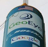
GeoEye-1 is the world’s highest-resolution commercial satellite, which is sponsored by Google, and has started sending satellite images, the first of which is that of Kutztown University in Pennsylvania.
 Wired reports that the GeoEye-1 spacecraft can take photos at a resolution of up to 41 centimeters close enough to zoom in on the home plate of a baseball diamond. They report that its key customer is National Geospatial-Intelligence Agency, a U.S. government agency that analyzes imagery in support of national security and Google is GeoEye’s second major partner.
While the GeoEye-1 will provide imagery to the NGA at the maximum resolution of 43 centimeters, Google will only receive images at a 50-centimeter resolution because of a government restriction, Brender explained. However, Google’s partnership with GeoEye is exclusive, meaning the search-engine giant will be the only online mapping site using the satellite’s photos.
Its amazing how high resolution Satellite imaging is changing the way we view the world sitting in front of our computers. Try finding your house on Google Maps, Google Earth, Live Search maps, or Yahoo! maps. Look into the skies with Microsoft’s WorldWide Telescope, or track the moon.